
“Egypt’s Antiquities Ministry is finalising the file it intends to present to UNESCO to request the addition of Saladin’s Citadel in Taba, Sinai, to UNESCO world heritage list,” archaeological expert Abdel-Rahim Rihan, managing director the ministry’s department of archaeological research and studies in Sinai and the Delta, said. “The file is supported support by several Egyptian authorities,” he said, “including South Sinai Governorate; the ministries of Interior, Defence, Foreign Affairs, and Tourism; as well as the Egyptian National committee of UNESCO.”
Dr Rihan said that the UNESCO file was prepared according to international standards for listing world heritage. The listing, he said, would go towards preserving the citadel and would contribute towards making the site a sustainable touristic spot.
“The citadel has been on Egypt’s heritage list since 1986,” Dr Rihan explained. It went through several restorations from 1982 to 1986, then in 1988, 1989, 2008, 2010, and 2012.”
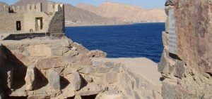
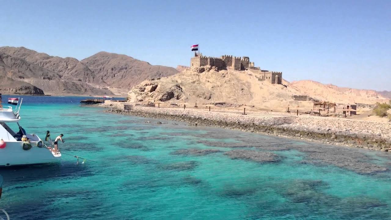
The Saladin citadel site on Pharaoh’s Island in Sinai provides a magnificent panorama that overlooks the surrounding sea and the border lands of Egypt, Israel, Jordan, and Saudi Arabia.
The site was of military importance since at least the Byzantine era; remains of a Byzantine church from the time of Justinian VI are still visible. The Crusaders later built a fort there, which was in turn renovated and partly rebuilt by Salah Eddin al-Ayubi, known as Saladin, in 1171 to protect Egypt’s eastern border against further possible Crusader attacks. When the Crusades came to an end (1291) the citadel lost its importance and went into disuse.
The citadel is located on a steep 285m high escarpment rising on a plateau which itself is 645m above sea level. It was supplied with drinking water from the Ayn Sadr spring some 5km away, through run-off waters behind a small dam to the north, or through the big cisterns dug in the ground. The building material was basically limestone which was abundant in the area, and a kind of mortar found near the run-off waters. A 5 – 6m ditch surrounds it. Extending from north-east to south-west over a length of between 100 and 150m with a maximum width of 120m, it is surrounded by a 2m thick wall reinforced at regular intervals with square and round towers. It was capable of a withstanding a long siege, with water tanks built into the rock. It included a furnace used for arms production, soldiers’ barracks, a bakery, mill and bathroom.


